Muth Fm
Type Locality and Naming
Named after Muth village in Spiti. Type section is in Mud village, Upper reaches of Pin River, Spiti region. [Original Publication: Stoliczka, F. 1865. Geological section across the Himalayan mountain range from Wangtu Bridge on the river Sutlej to Sungdeo with an account of formations in Spiti accompanied by a revision of all known fossils from that district. Memoirs of Geological Survey of India, 5: 153p. Redefined by Srikantia, S.V., 1981. The lithostratigraphy, sedimentation and structure of Proterozoic–Phanerozoic formations of Spiti basin in the Higher Himalaya of Himachal Pradesh, India. In: Sinha, A.K. (Ed.), Contemporary Geoscientific Researches in India (a commemorative volume in honour of S.P. Nautiyal). Bishen Singh Mahendra Pal Singh, Dehra Dun, pp. 31–48.]
In the Kumaun-Garhwal region, the reference section lies in Kuti region near Byas area, Kumaun Tethyan Himalaya. [Original Publication: Kumar, S., Singh, I.B., and Singh, S.K. 1977. Lithostratigraphy, structure, depositional environment, palaeocurrent and trace fossils of the Tethyan sediments of Malla Johar area, Pithoragarh-Chamoli districts, Uttar Pradesh, India. Jour Pal Soc. India, 20, 396-435; Heim, A. and Gansser, A. 1939. Central Himalaya: Geological observations of Swiss expedition 1936; Reprinted Delhi Hind. Publ. Co. 246]
Synonyms: Muth Quartzite; Griesbach, 1891 “Muth Series”; (Stoliczka, 1865); Kumar et al., 1977 re-designated it as Muth Formation.
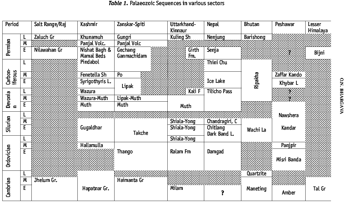
[Figure: Zanskar-Spiti-Kumaun region location (provided by Om Bhargava)]
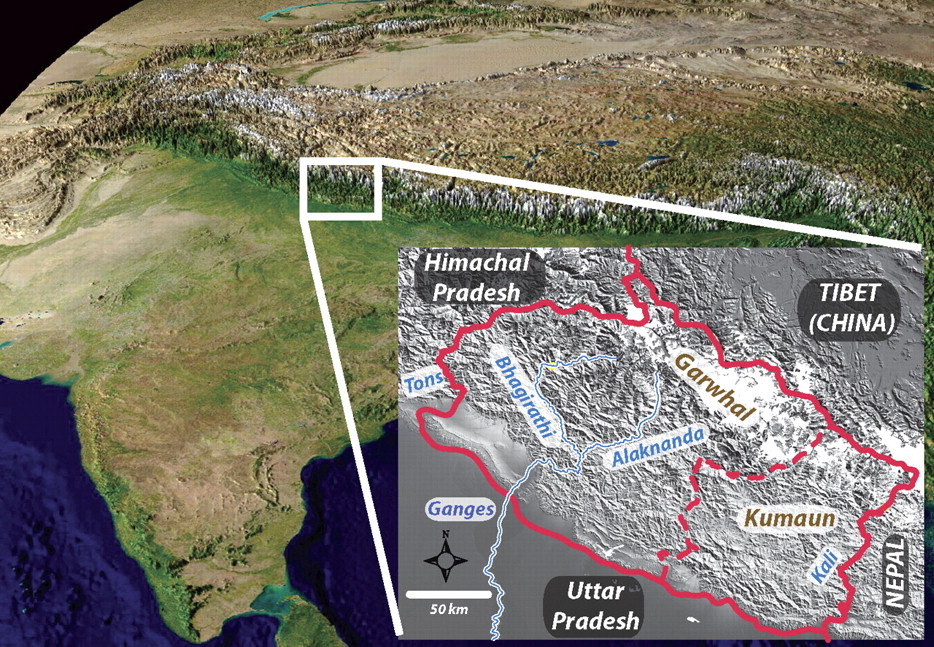
[Figure 1: Location of the Kumaun-Garhwal region (from Celerier et al., GSA Bull 2009)]
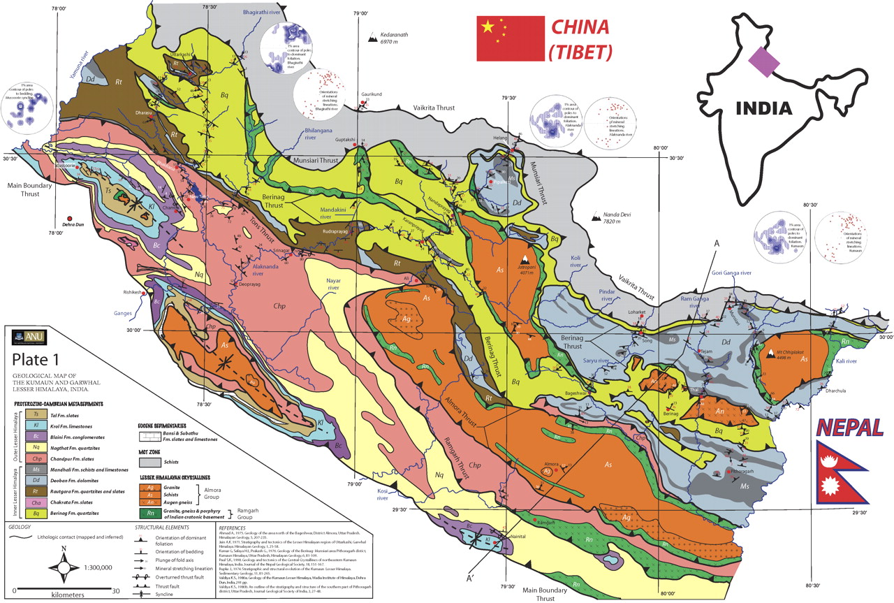
[Figure 2: Geologic map of the Kumaun-Garhwal region (from Celerier et al., GSA Bull 2009)]
Lithology and Thickness
Sandstone. Massive quartz arenite, locally thin quartz arenite, dolomite, and massive sugary quartzite. 400-800 m thick in Kumaun-Garhwal region. Singh (2009; Raju chart) details in Kumaun entry: (a) Fossiliferous 10 cm - 6 m iron-rich grey dolomite in basal part.; (b) White mottled moderately well-sorted, subrounded to rounded white, sporadically grey fine to medium grained sandstone, local pebble beds with clasts of white sandstone. Matrix (25%) is of cryptocrystalline silica-frosted and bimodal quartz grains. (c) White sandstone and grey dolomite.
[Figure 1: Field photograph showing the contact of Takche and Muth Formation in the Pin Valley, Spiti region, Himalaya.]
Relationships and Distribution
Lower contact
Zanskar-Spiti region = Disconformable with underlying the Takche Fm making a sedimentologic break between (Bhargava and Bassi, 1998).
Kumaun-Garhwal region = Gradational contact with the Variegated Fm (Bamras Fm), and some places it is unconformable (Sinha, 1989). [Note: The Muth Fm is usually assigned as middle Devonian, but the Variegated Fm is assigned as Silurian.]
Upper contact
Zanskar-Spiti region = Gradational with the overlying Lipak Fm (Bhargava and Bassi, 1998)
Kumaun-Garhwal region = conformable upper contact with Jumbuodiyar Fm (Malviya et al., 1991)
GeoJSON
Fossils
Zanskar-Spiti region = Cephalopod: Stewartophyllum sp. (Ameta and Gaur, 1980); Trace fossils are (Bhargava and Bassi, 1988) Planolites; Paleophycus tubularis; Arenicolites; Skolithos and arthropods trackways; Brachiopods: (Bassi, 1988) Orthis cff. Rustica; Diplichnites gouldi, Diplododichnus biformis, Palmichnium antacrcticum, Selenichnites sp., and Taenidium (Draganits et al., 1997).
Kumaun-Garhwal region = Leptaena rhomboidalis; Atrypa reticularis; Schelluienella william; Pentamesisera sp.; Streptlasmatid; Chondrites sp.; Pholeous etc.
Age
Depositional setting
Beach-Barrier island system (Bhargava and Bassi, 1998; Draganits et al., 2001; Draganits et al., 1999, 2003)
Additional Information


